Landslide mitigation at Vela Voda
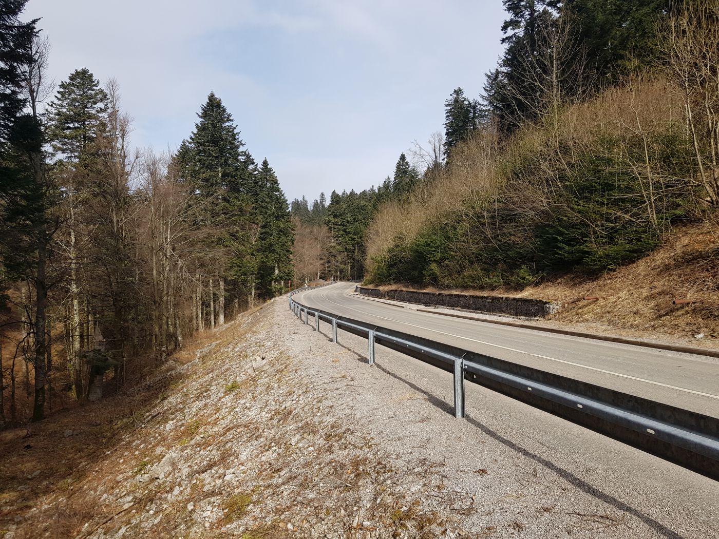
A landslide of approximately 110 m in width and 40 m in length occurred on a part of an unstable slope along the western edge of county road in Gorski
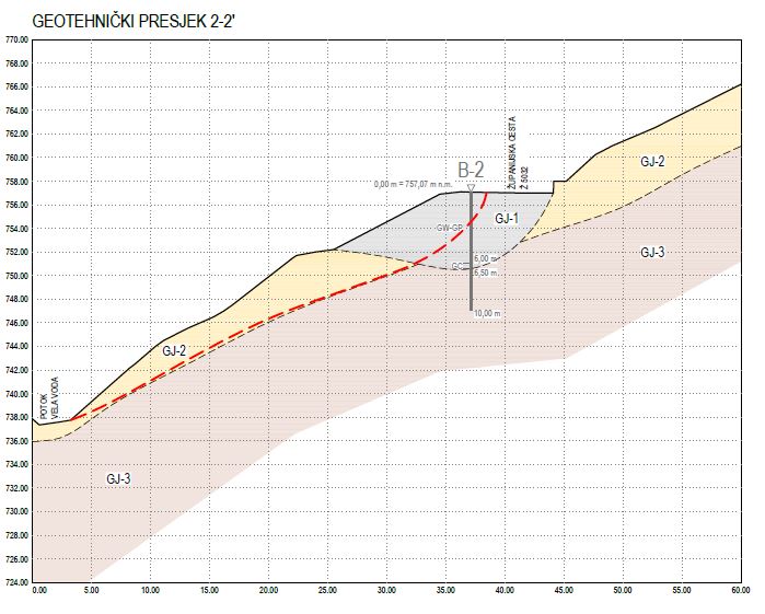
Geotechnical exploration and investigation works
We have carried out engineering geological and geotechnical exploration and investigation
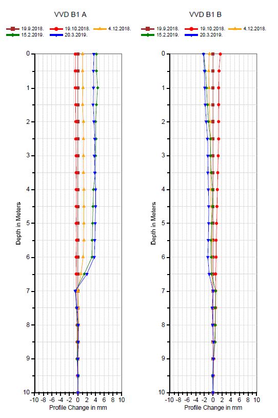
The observation included 5 horizontal displacement measurements carried out at one-month intervals, with a total duration of 182 days. By analyzing the measured displacements, we were able to determine the location of the sliding surface at a depth of approximately 7 m.
Based on the exploration and investigation works, we have concluded that the explored landslide was the result of many factors such as unfavorable slope of terrain, geotechnical profile of the location, groundwater seepage paths, road embankment load on the slope, and continuous unloading of the landslide toe due to the constant Vela Voda stream that erodes it.
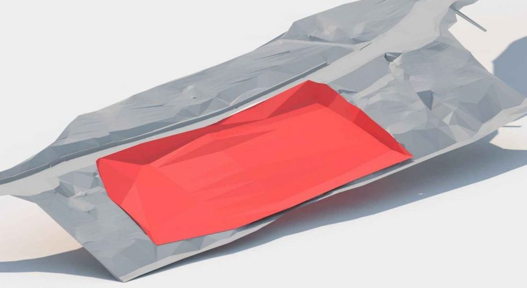
In order to optimize the design-making process as much as possible, we have created a 3D geological model to provide better insight into the spatial slide distribution. This way it was possible to choose suitable landslide mitigation measures.
Landslide mitigation measures
Landslide mitigation included works carried out to increase the overall slope stability and the performance of the precipitation drainage system.
In order to perform landslide mitigation and achieve road stability, the construction of a pile wall of reinforced concrete piles D = 800.0 mm in diameter, L = 12.0 m in length and with
In order to lower the groundwater level, it is necessary to reconstruct the precipitation drainage
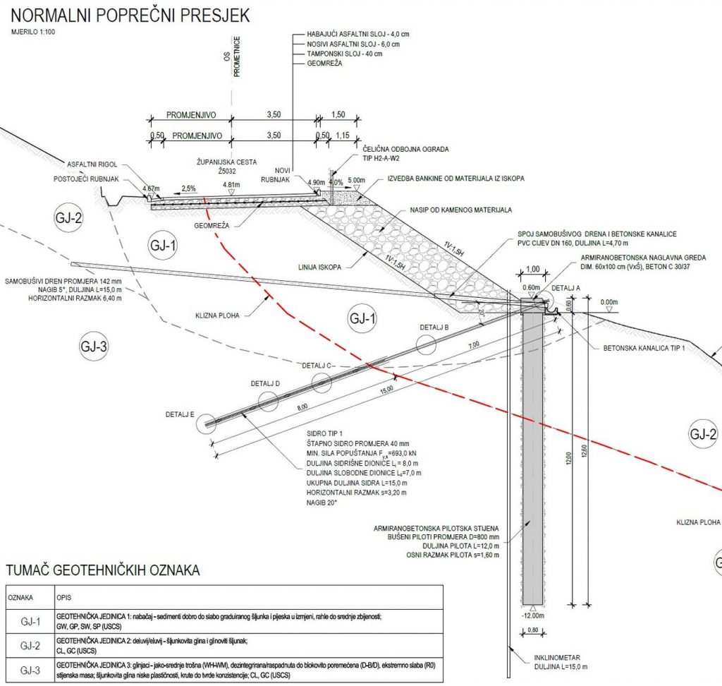
In order to check the success of the designed works, it is necessary to perform systematic observations during the execution and during the exploitation afterward. For this purpose, two vertical inclinometers and
The model with the abovementioned mitigation measures is shown below.
Read more: Landslide mitigation