Slope and rockfall protection on the location Banska vrata in Rijeka
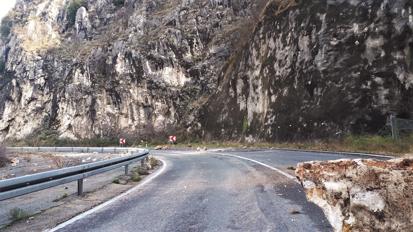
Rockfall, of smaller or larger scope, is a frequent occurrence along Croatian roads, especially in mountainous areas. In January 2020, a rockfall occurred near the Banska Vrata tunnel in Rijeka. Unstable blocks weighing up to several tons fell on the road and it was closed for traffic for a while. In order to ensure safe traffic conditions along the observed part of the section, we carried out geotechnical investigation and testing and made a geotechnical report as well as the main and detailed rockfall and slope protection design.
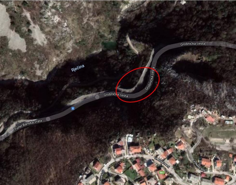
The section is located on the D3 State Road, at the 4 + 817-km stationing, past the Banska Vrata tunnel and in the direction of Orehovica. This location is characterised by steep to subvertical rock cliffs as high as 100.0 m and over on the south side of the road and the canyon of the Rječina River on its north side. The length of the observed part of the section is about 130.0 m.
Geotechnical investigation and testing
We carried out the engineering and geological mapping, slope categorisation, the geological prospecting of the wider area, the geotechnical prospecting of the location and the data processing of previous investigation for the geotechnical report and made a main and detailed rockfall and slope protection design. The geotechnical and engineering geological investigation and testing were conducted in September and October of 2020.
Considering the significant dimensions as well as the height and inaccessibility of the greater part of the project location, the geodetic survey of the location from the air was done using a drone. Based on aerial photogrammetric images, a 3D digital terrain model in the form of point clouds was created. By using the obtained point cloud, better insight was gained into the broader picture of the entire project and into the individual condition of the parts of the slope that were difficult to access.
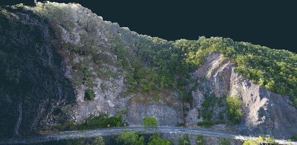
The combination of remote sensing and field prospecting of the observed rock slope was divided into three separate engineering and geological zones of different characteristics and potential types of instability.
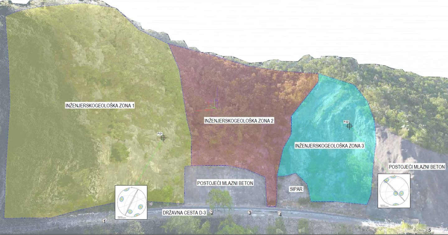
Engineering and geological zones / Engineering and geological features:
Zone 1 – Medium- to low-weathered Palaeogene limestone – potential instabilities: rockfall of blocks with a volume between approx. 0.5 m3 and 10.0 m3 accentuated by structurally conditioned rock mass failure (planar collapse, wedge failure and toppling) and blocks weakened by atmospheric action and bioerosion.
Zone 2 – High- to medium-weathered Upper Cretaceous limestone – potential instabilities: unstable blocks related to the fault zone are present, subordinate blocks weakened by atmospheric action and bioerosion with structurally conditioned rock mass failure (planar failure, wedge failure and toppling), erosion and scattering of deluvial / eluvial deposits. On 27 January 2020, blocks of rock mass of approximately 10.0 m3 became separated.
Zone 3 – High- to medium-weathered Upper Cretaceous limestone – potential instabilities: unstable blocks related to the fault zone are present, subordinate blocks with a volume of approx. 1.0 m3 loosened by atmospheric action and bioerosion with structurally conditioned rock mass failures (planar failure, wedge failure and toppling).
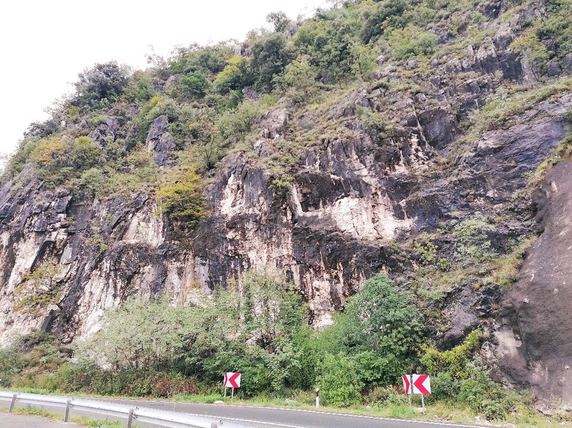
Rockfall and slope protection — remediation measures
As part of rockfall and slope protection, works aimed at increasing slope stability and rockfall protection are planned. A total of nine protection positions with the installation of three barriers for rockfall protection are planned. The positions of the barriers and other protection measures are shown in the figure below.
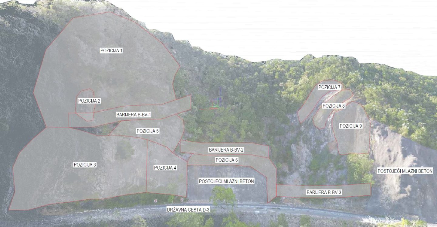
Protection position / Protection measures:
Position 1 – Removal of potentially unstable blocks from the slope
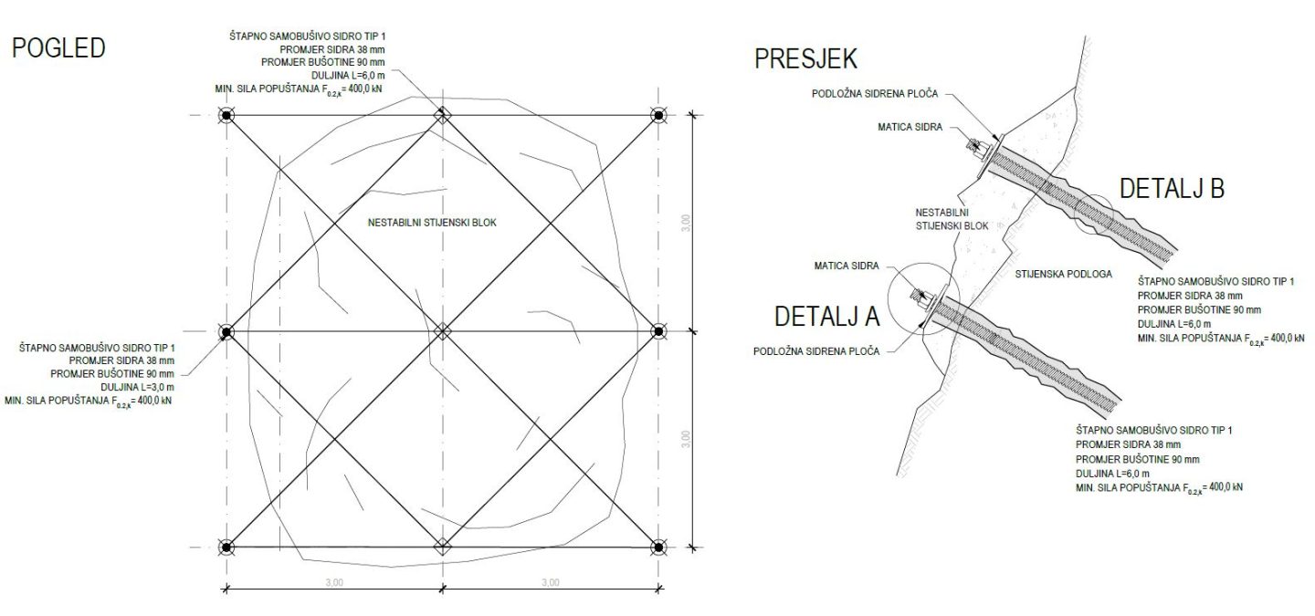
Position 2 – Installation of self-drilling rock bolts with a length between 3.0 m and 6.0 m and steel ropes with a diameter of 12.0 mm in order to secure potentially unstable blocks
Positions 3, 5, 7, 8 and 9 – Installation of a mesh of braided steel cables and self-drilling rock bolts on a general grid of 3.0 m × 3.0 m
Positions 4 and 6 – Installation of a protective hexagonal mesh, type 8 × 10
The lengths of the self-drilling rock bolts vary by position depending on the purpose of protection (overall stability protection of the slopes or of individual unstable blocks) and along the project area are 3.0 m, 6.0 m, 9.0 m and 12.0 m. The removal of vegetation present at the shown positions is planned before works begin.
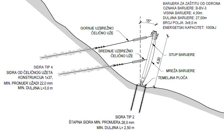
Protection from future rockfall includes the construction of three barriers for rockfall protection with potential energy absorption of 1000.0 kJ and 1500.0 kJ and height of 4.0 m and 5.0 m. The individual lengths of the planned barriers are 27.0 m, 40.0 m and 50.0 m
Conclusion
Because of the frequent occurrence of instability on parts of the observed slope, as well as the importance of the mentioned section of the D3 State Road, it was necessary to determine the causes and to prepare the rockfall and slope protection design.
Because of the great height and inaccessibility of the slope, a combination of field investigation and the analysis of the results of the processing of aerial photogrammetric images (point cloud) was chosen. In this way, the time spent collecting the data required for the preparation of a complete engineering, geological and geotechnical prospection, as well as calculating quantities during the preparation of the project documentation, was significantly shortened.
Read more: Using unmanned aircraft systems and 3D models for designing slope remediation projects
