Hrib landslide remediation on local road L58007
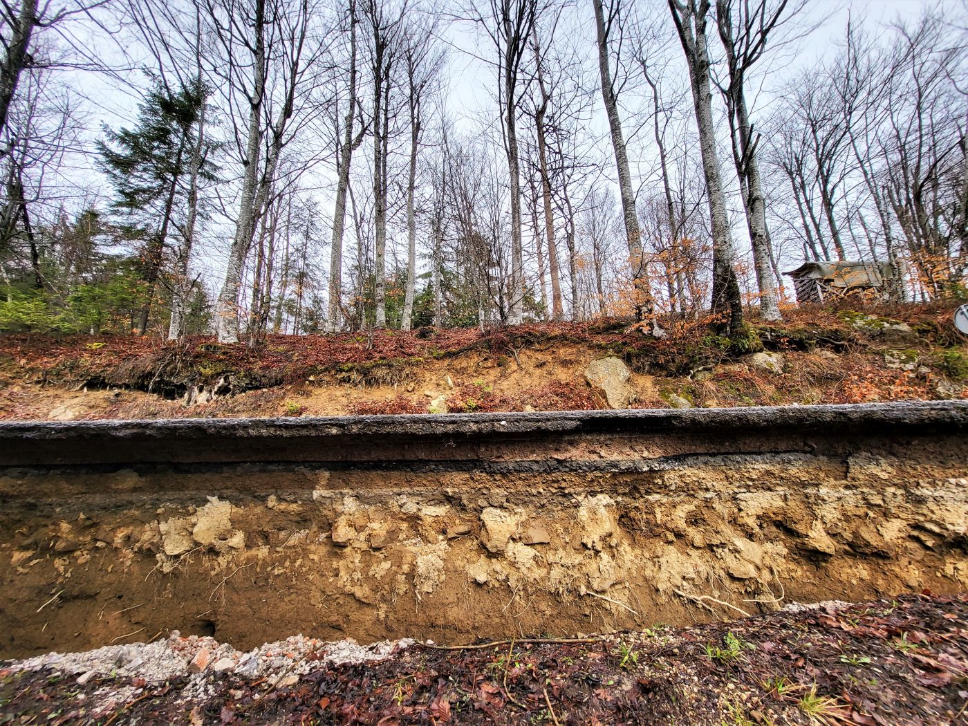
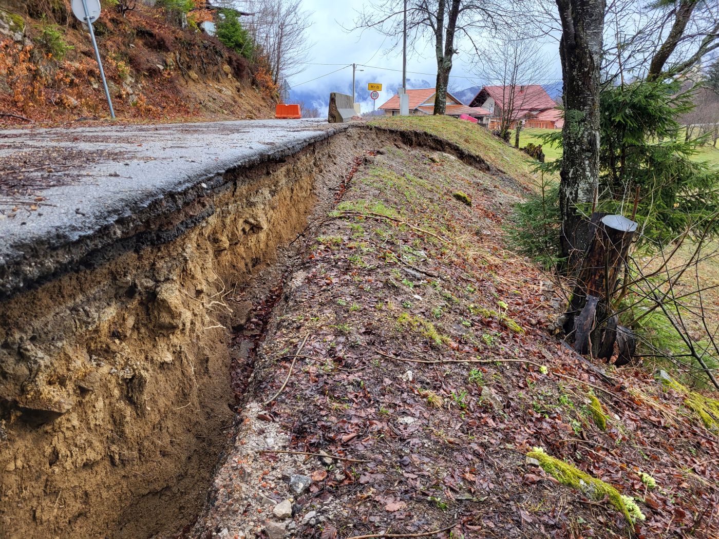
In the Primorje-Gorski Kotar County, in the village of Hrib, a landslide with a width of 35.0 m and a length of 47.0 m has occurred. The landslide is characterized by its vertical front crack measuring 1.0 m in height and three secondary front cracks ranging between 10.0 m and 18.0 m within the body of the landslide. The cause of the sliding material is most likely a combination of an inadequately designed drainage system of the pavement and the slope, the unfavorable slope and its exposure to rainfall and traffic load.
Geotechnical investigation and testing
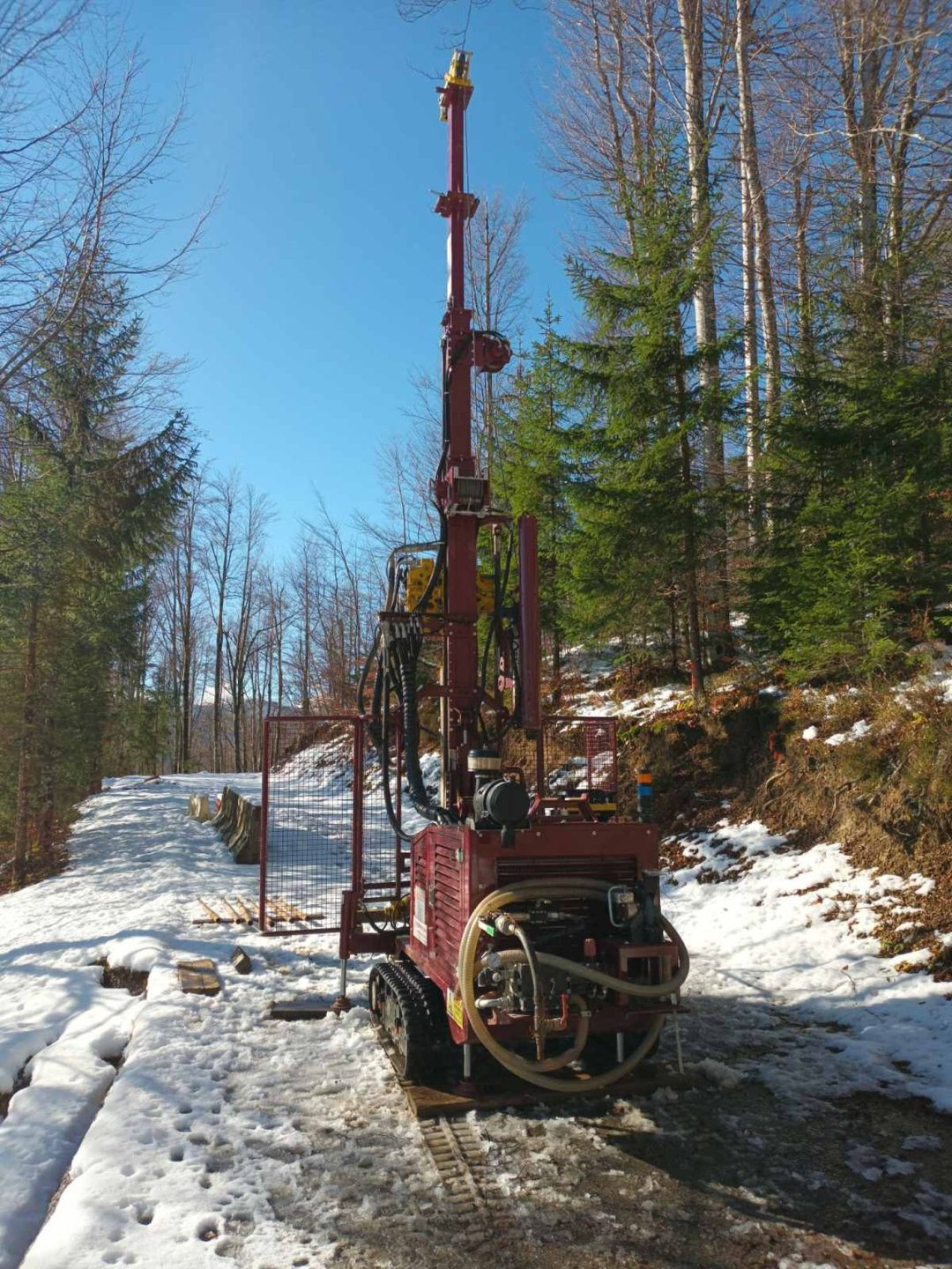
For the purpose of the landslide remediation design, we conducted engineering, geological and geotechnical investigation and testing. In addition to geological and geotechnical prospecting of the wider area and engineering as well as geological mapping of the terrain, geophysical tests, standard penetration tests (SPTs) and exploratory drilling were also carried out. A total of seven exploratory rotary boreholes of individual lengths ranging from 1.0 m to 10.0 m, with a total length of 30.5 m, were drilled. The drilled boreholes were used to determine the geotechnical characteristics of the location and the underlying soil, as well as for further laboratory tests.
Based on all the conducted investigation and testing, a laboratory and geotechnical report were created, in which the layout of the sliding surface and its dimensions were determined in more detail.
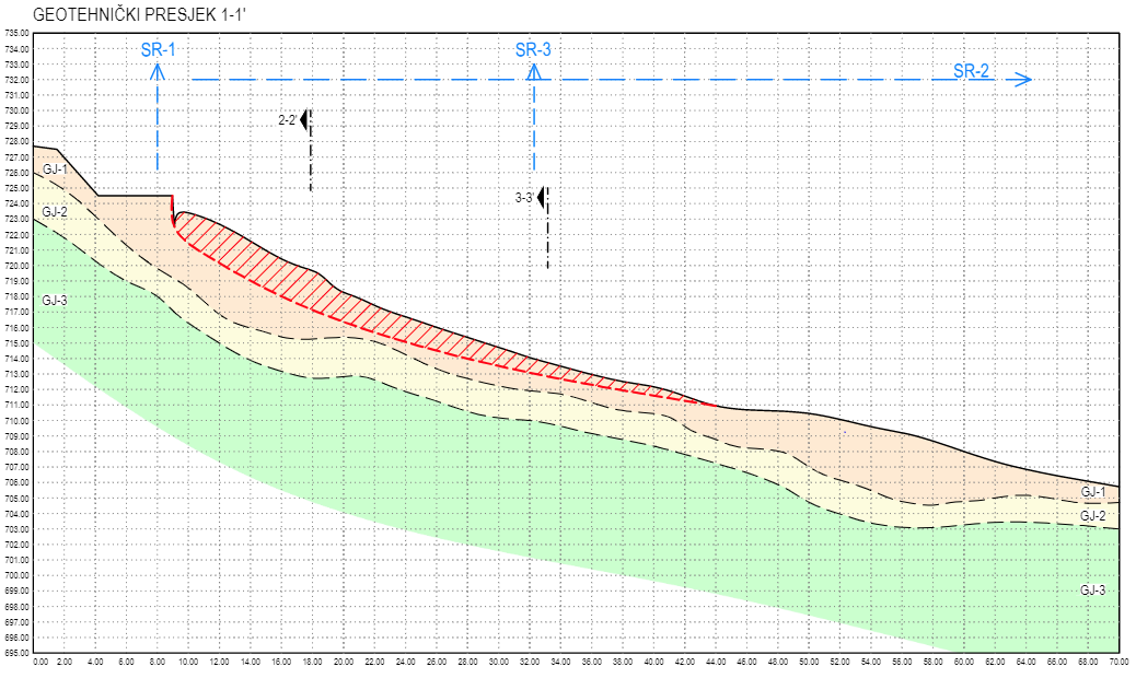
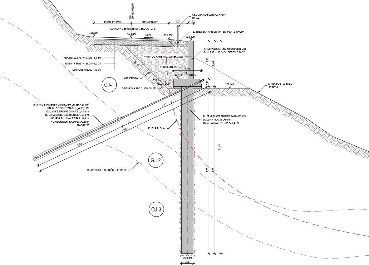
The geotechnical profile itself is composed of three geotechnical units: made ground (GJ-1), highly weathered clastites (GJ-2) and medium-weathered clastites (GJ-3). It has been determined that the sliding surface is mostly manifested in the made ground layer, i.e., completely eroded clastites.
Remediation measurements
As part of the landslide remediation, works to increase the global stability of the slope are planned, as well as the construction of a rainwater drainage system and the reconstruction of the damaged road.
Landslide remediation is planned to be carried out by the construction of a pile wall made of reinforced concrete drilled piles. The length of each pile is L = 9.0 m and nominal diameter is D = 620.0 mm, placed at a horizontal axial distance of s = 1.4 m. On top of the piles, a reinforced concrete capping beam in the form of a retaining wall for the road is planned, with a height of h = 2.45 m and foundation width of b = 1.5 m. One row of self-drilling anchors of length L = 10.0 m will be installed through the retaining wall (capping beam) at a horizontal axial distance of s = 2.8 m. In addition to the aforementioned works to ensure the global stability of the slope, the reconstruction of the road and the construction of a stormwater and deep drainage system in the wider zone of the landslide are planned.
In order to verify the success of the designed interventions, systematic observation is planned to be carried out during the execution of the works and subsequently during exploitation. For this purpose, a vertical inclinometer with a length of L = 12.0 m for measuring displacement is planned. It is also planned to test all the conducted piles in order to check their characteristics in accordance with the project requirements.
Read more: Landslide remediation designs
