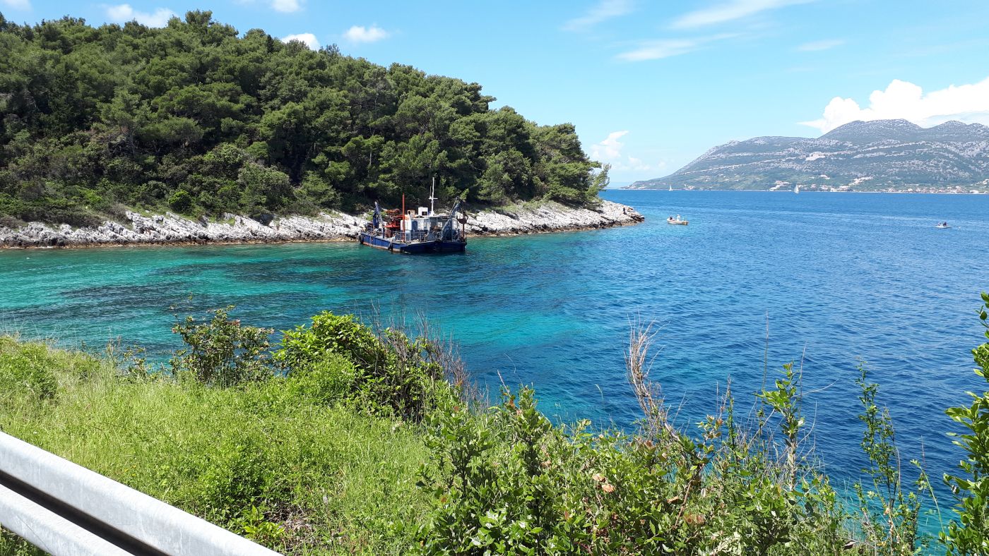
Geotechnical and engineering geological exploration and investigation works – Korčula port, location Polačište
Planned work – construction of the new Korčula port, location Polačište
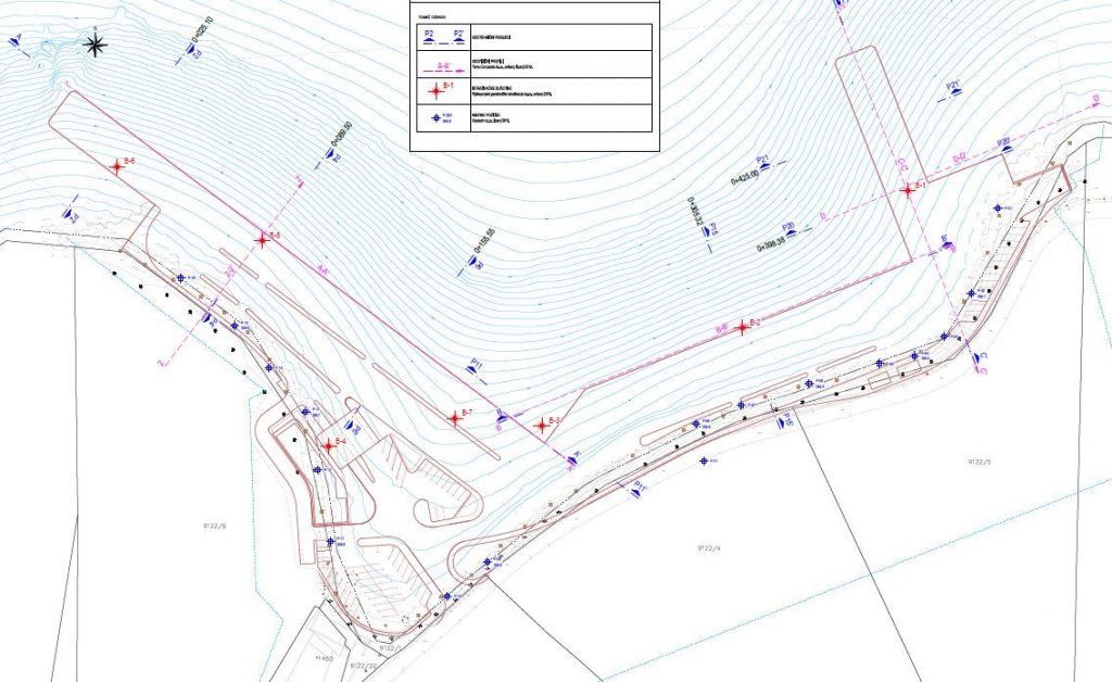
The project site is located at Polačište, on the northern side of Korčula island, approximately 1.5 km west of the old town of Korčula, within the construction area of Zrnovo town. The planned structure will be a port open for public transport, primarily for the reception of vessels, both from domestic and international traffic, as well as for supply vessels, tourist vessels etc.
Port construction plans include the construction of an operating quay in the eastern part of the port, an east coast wall, a west coast wall, a quay as the extension of the west coast wall, and a passenger terminal building and several smaller buildings.

Geotechnical exploration and investigation works
The geotechnical and engineering geological works for the construction of the new port for public transport, of significance for the whole county, were carried out from May to June 2019 and they included:
- Exploratory rotary offshore drilling
- Geophysical testing
- Engineering geological mapping of the location and determination of drilling cores
- Laboratory testing of soil and rock samples
- Sclerometer tests
- Data processing of previous research
Exploratory rotary offshore drilling
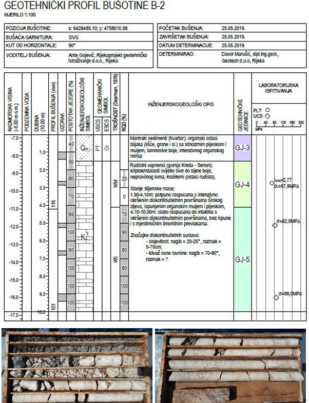
For the purpose of completing the geotechnical elaboration documentation, seven (7) offshore rotational boreholes were conducted, with individual lengths of 7.5 m to 15.8 m and a total length of 79.9 m. Boreholes were used to define the geotechnical features of the location and soil foundation. The offshore exploratory drilling was carried out from a vessel with two legs, tied to the coast and the anchors using ropes and steel cables.

The following types of exploratory drilling were conducted:
- Core drilling in soil
- Core drilling in rock mass
The drilling was performed by applying the rotary core drilling method and using suitable drilling equipment. For drilling in sediment or weathered rock, a diamond crown made of specially treated steel was used. For drilling in compact rock, a diamond crown made of specially treated steel that is also wear-resistant was used. A double core tube tool was used in order to reduce the possible damage to the core (usually caused by the rotation of the core tube and the passing of cooling and rinsing water). The casing is used to guide the drilling tool through the marine medium to the borehole entrance in order to protect the borehole from collapsing.

Geophysical testing
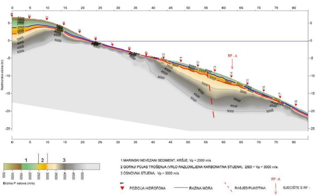
The conducted geotechnical and engineering geological exploration and investigation works included geophysical testing under the sea using the shallow seismic P-wave (Delta-T-V-method) method.
The seismic refraction method is based on measuring the time spread of elastic seismic waves from source to geophone, through subsurface geological structure. The waves are reflected and refracted on the boundaries of the material, the difference of which is determined by changes in their density and deformation properties. Measuring the velocities of elastic waves in the subsoil below the seabed determined the thickness of marine sediments, the weathering area of base rock, the depth to the base rock, and the possible occurrence of faults, cracks and more fractured zones on predefined profile tracks.
Seismic refraction tests were performed in the investigated area on a total of five (5) seismic profiles of individual lengths from 85.0 m to 235.0 m, with a total length of 783.0 m.
Laboratory testing and sclerometer testing
Laboratory tests were conducted to obtain input data for soil and rock classification and to prepare calculations as a part of the project documentation. The following types of tests have been conducted:
- Soil testing: soil particle density, granulometric analysis, direct shear test, oedometer test
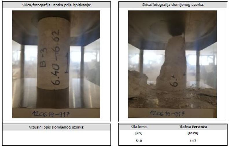
- Rock testing: compressive strength test and elasticity module test, PLT test, rock density test
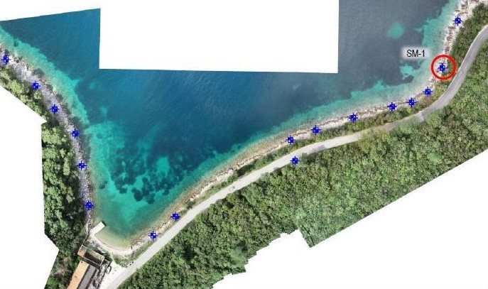
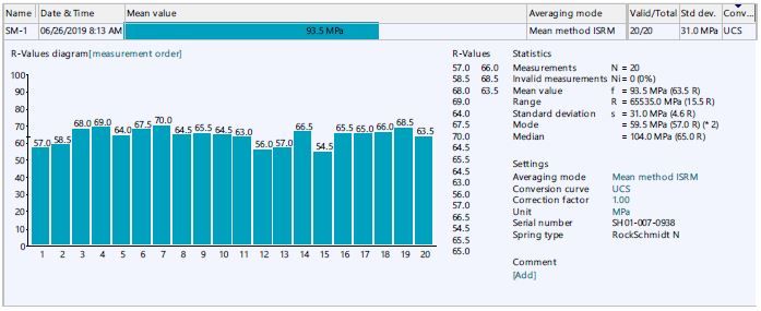
The sclerometer test (bounce hammer or Schmidt hammer) included a field, in situ test of intact rock on detected rock mass. Using a sclerometer (RockSchmidt type N) test, it is possible, under laboratory conditions as well as in situ, to determine the uniaxial compressive strength (UCS) of the intact rock tested. A total of eight (8) sclerometer tests were performed as part of these tests.
Engineering geological mapping of the location and determination of drilling cores
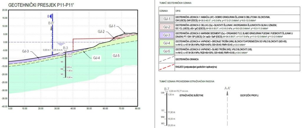
Geotechnical and engineering geological works included geotechnical prospecting and engineering geological mapping of the location, inspection and determination of drilling cores, composition of collected data, drafting of geotechnical cross-sections and geotechnical profiles of boreholes. As part of engineering geological mapping of the location, geological prospecting of the wider area was conducted, with an emphasis on morphology and active geomorphological processes.
Conclusion
Geotechnical and engineering geological works were used to determine the specific engineering geological units in order to prepare the geotechnical documentation and the documentation for the entire project of the construction of the new port of Korčula, location Polačište. The geotechnical profile of the location was made of five geotechnical units, shown in the table below:

The combination of different geotechnical and engineering geological exploration and investigation works and the correct interpretation of collected data helped provide the best possible insight into the geotechnical soil profile. This way potential foundation and future structure design problems can be anticipated and resolved on time.
Read more: Exploratory drilling
