Dubravci landslide remediation on state road DC3
The remediation works on the Dubravci landslide, located on state road DC3, section 012, at km 4+400 in Karlovac County, have been completed. For this project, we carried out the engineering geological and geotechnical investigation and testing and made the main and detailed landslide remediation designs.
We also carried out the complete supervision of the remediation during the works. This included the analyzing and verifying the situation in the field and adjusting the design.
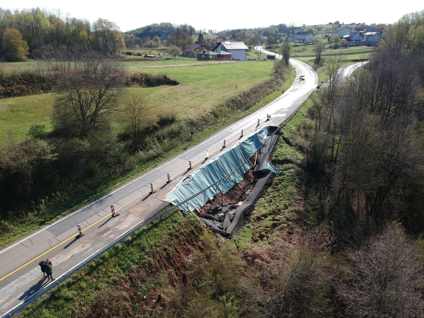
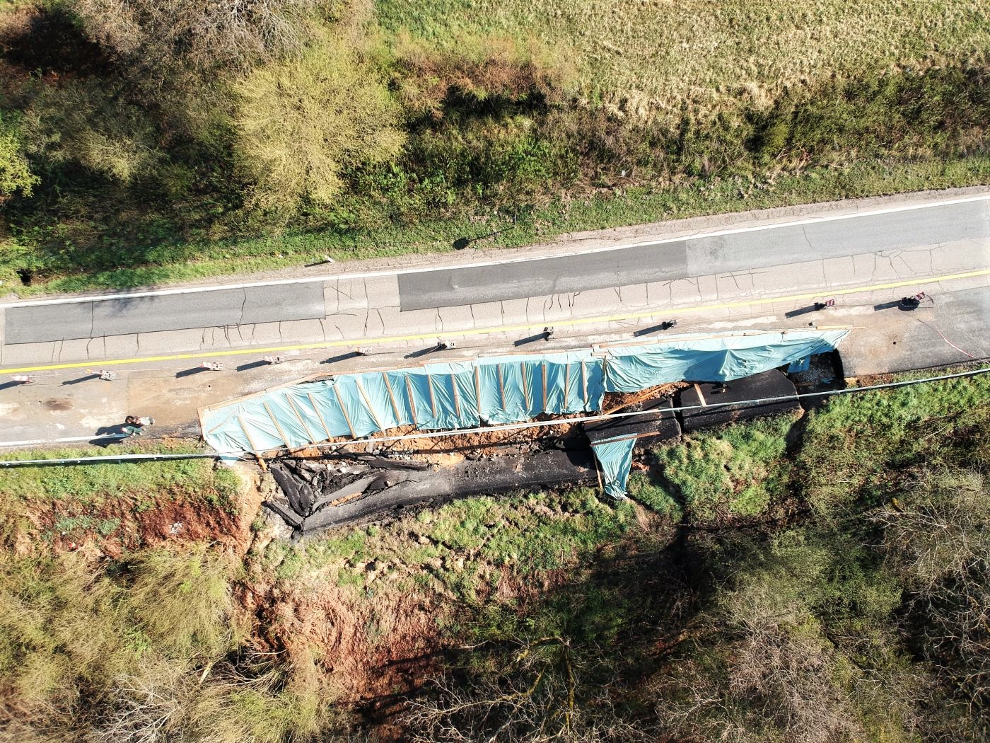
The Dubravci landslide is located west of the Dubravci town, on state road DC3, section 012 at km 4+400, in Karlovac County. The DC3 runs in the general northwest-southeast direction on the investigated part of the section, and it crosses the natural slope with an inclination of approx. 25° to the southwest. The route of the road was made by partially cutting and filling the existing terrain, which formed cuttings along the left edge of the road and embankments along the right edge. The existing embankments and cuts were unprotected before the remediation, with no retaining structures. Along the left edge of the road, there were unorganized channels for storm water drainage, which diverted the water towards the existing concrete culvert. Numerous layers of asphalt and repaired cracks were found on the existing road, which indicated a systematic sliding of the material over a long period of time. The elevations of the terrain range from approx. 175.0 to 191.0 m.a.s.l., while the elevations of the road within the catchment range from approx. 185.0 to 190.0 m.a.s.l.
In December 2020, the earthquake in Banovina activated the sliding of already unstable road material and caused a crack of a height of approx. 3.5 m to open. An inspection in the field found that the landslide had progressed; this was evident from the additional material settling, accumulation climbing in the reservoir in the southeast direction, water seeping at the bottom of the reservoir, terrain dredging and trees leaning.
Geotechnical investigation and testing
For the main and detailed landslide remediation designs, we carried out engineering geological and geotechnical investigation and testing that included:
• geological and geotechnical prospecting of the terrain;
• exploratory drilling;
• engineering geological mapping of the terrain and determination of drilling cores;
• standard penetration tests (SPT);
• laboratory sample tests; and
• previous investigation data processing.
Remediation measures
The remediation design for the Dubravci landslide on state road DC3, section 012, at km 4+400, included works aimed at increasing the overall stability of the slope, constructing a rainwater drainage system, and reconstructing the road. Landslide remediation included implementing the following remediation measures:
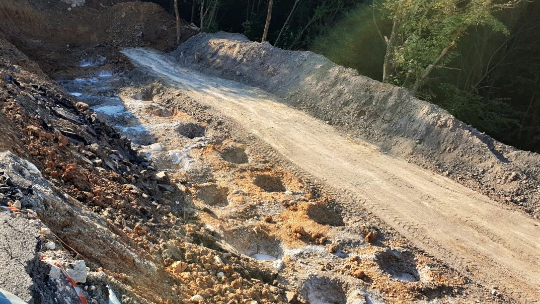
– construction of a pile wall from reinforced concrete drilled piles;
– construction of a drainage system; and
– road reconstruction.
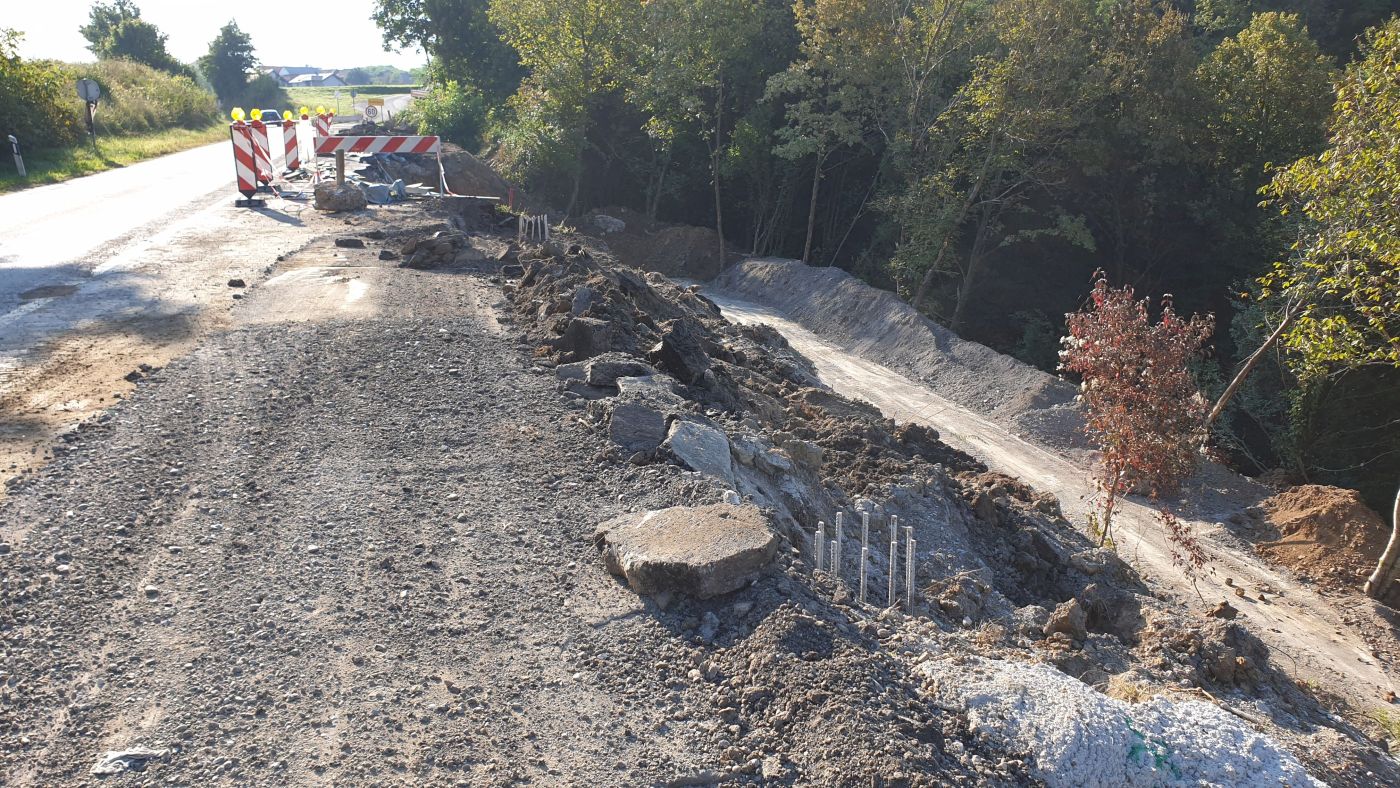
Before the works could begin, the existing steel buffer fence and the vegetation, the bushes and trees, were removed from the site. After these were cleared, the positions of the slope protection measures based on project data were staked and marked (height and position).
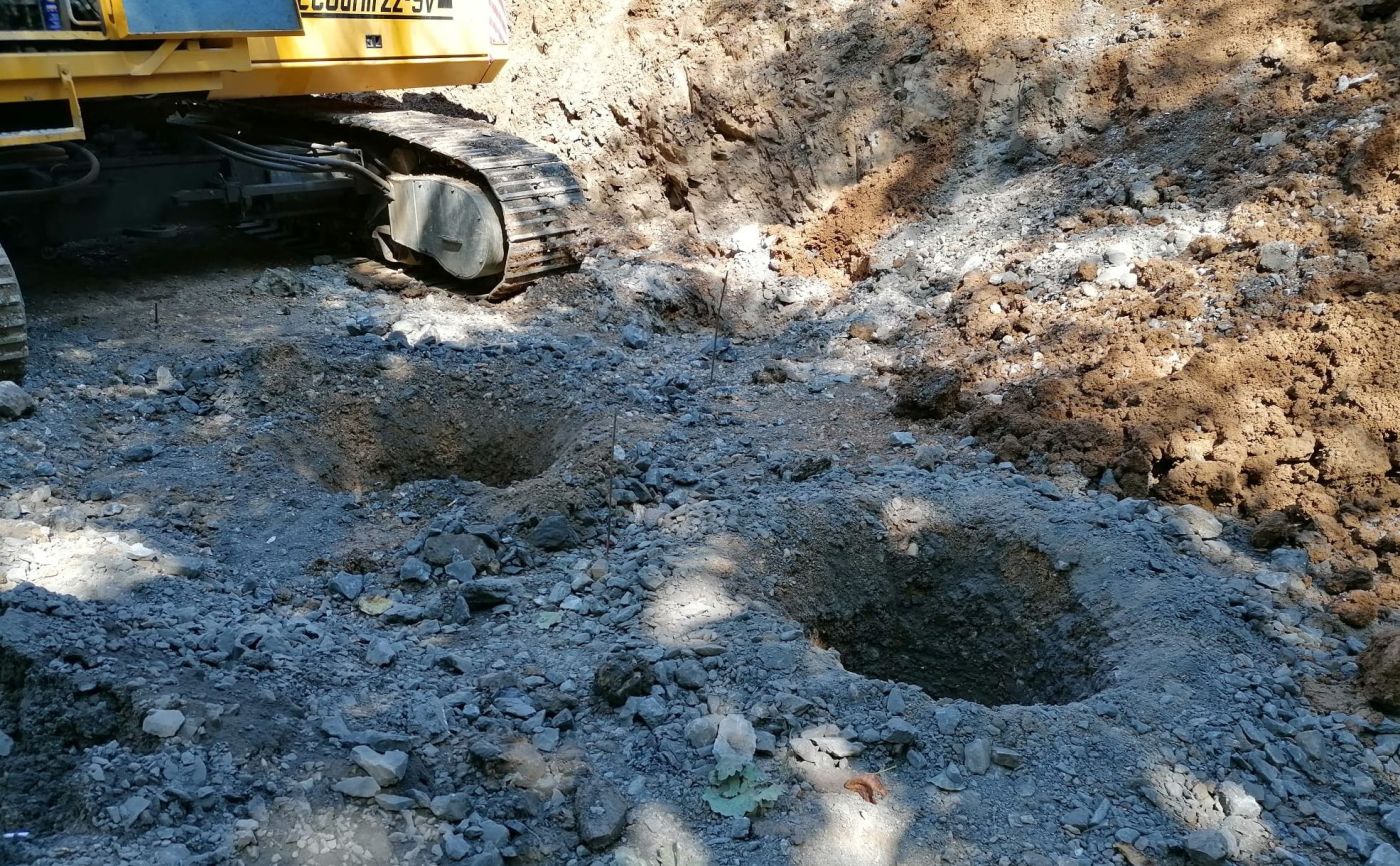
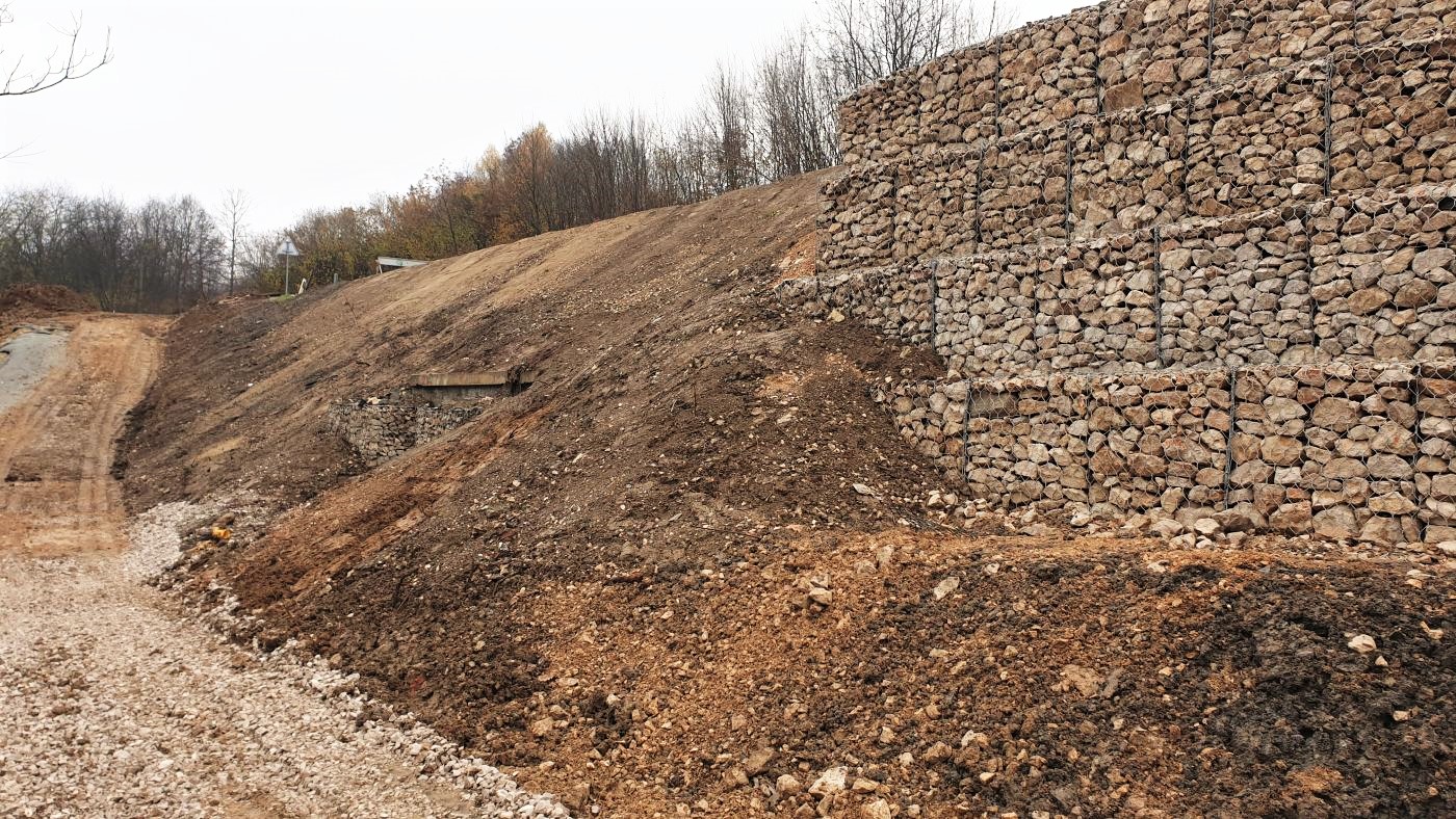
In order to protect the central part of the landslide, a pile wall of reinforced concrete drilled piles with a length of L=10.0 m in two rows at an axial distance of 2.50 m in the longitudinal and transverse directions was constructed. After the construction of the piles, a layer of mechanically stabilized granular stone material with a granulation of Ø 0–63 mm and a thickness of 75.0 cm was laid. A geogrid was embedded inside the stone material.
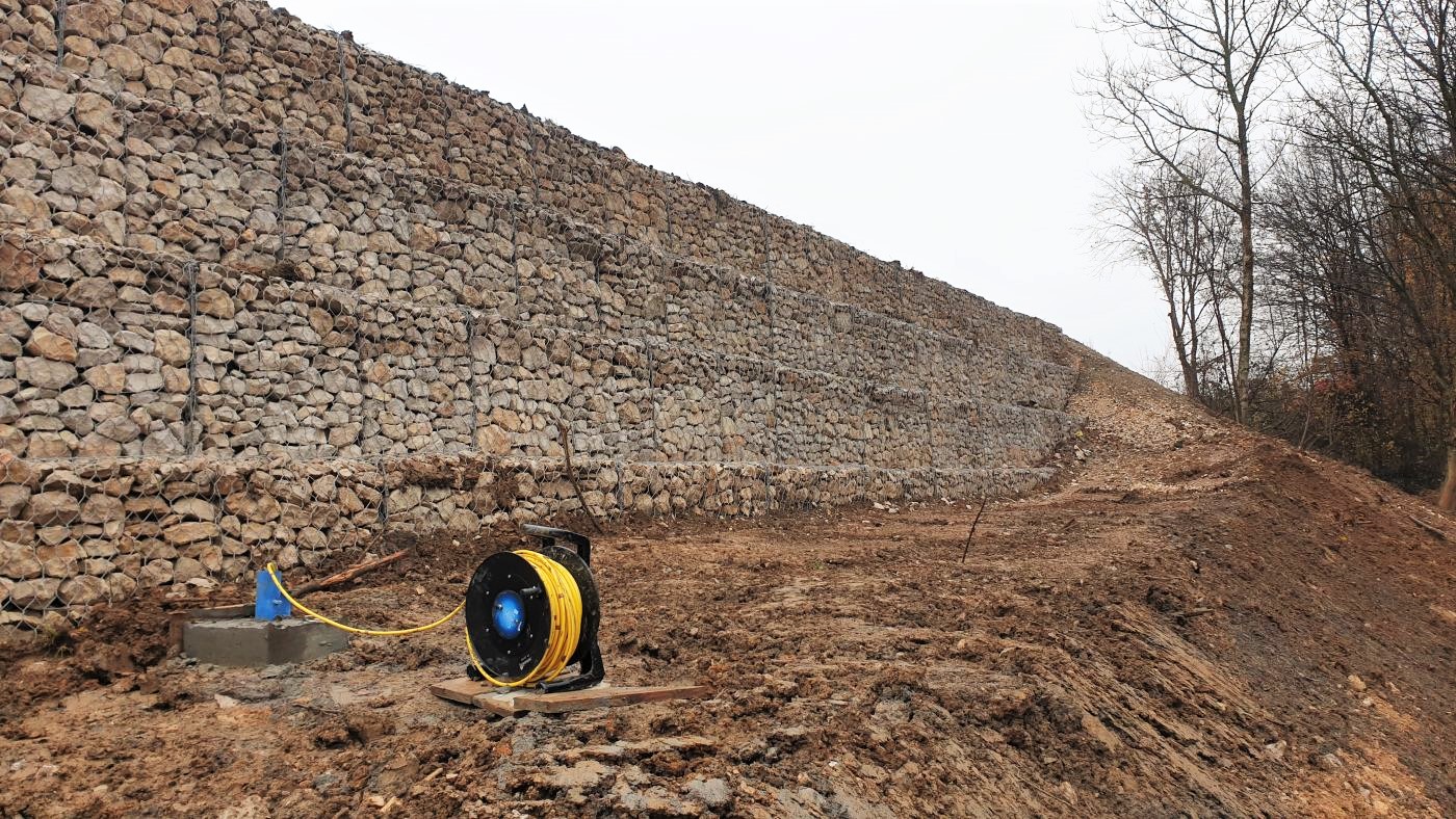
In the next phase, a Terramesh system was built to protect the central part of the landslide. The gabion baskets with the dimensions 1.0 x 1.0 x 2.0 m are made in five rows. The total length of the Terramesh system was 4.0 m, and the geotextile was laid on the back face of the gabion.
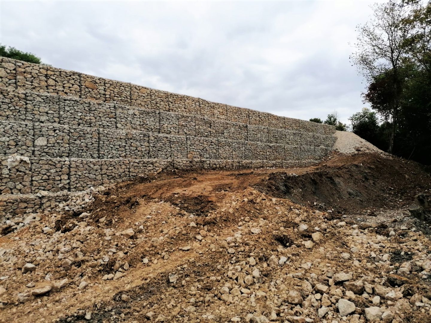
In order to protect the sides of the landslide, a pile wall of reinforced concrete drilled piles with a length of L=10.0 m in one row at an axial distance of 2.25 m was constructed. After the construction of the piles, a reinforced concrete capping beam of 0.50×0.80 m, made of concrete of compressive strength class C 30/37, was constructed.
The execution of the storm drainage system included laying a drainage PVC pipe with a nominal diameter of DN 250 mm behind the Terramesh system, installing stone drainage material with a granulation of 4 – 32 mm around the drainage pipe, covering the drainage material with geotextiles, constructing a culvert by installing a concrete pipe with a nominal diameter of DN 800 mm, and constructing the culvert discharge by installing concrete channels for draining rainwater from the landslide zone.
The following works were conducted in the scope of the roadway pavement reconstruction: the asphalt layers of the existing roadway were cut and removed, the existing roadway structure was excavated, geotextile was laid at the bottom of the excavation, a replacement layer of stone material was executed, a load-bearing layer of the roadway was executed, a load-bearing and wearing layer of the asphalt curtain was executed, a steel barrier was constructed from the south side of the road, and horizontal traffic signals were installed.
During the works, a pile integrity test (PIT) was conducted on all the piles. A total of 54 piles were executed on the landslide (the central part and the sides of the landslide).
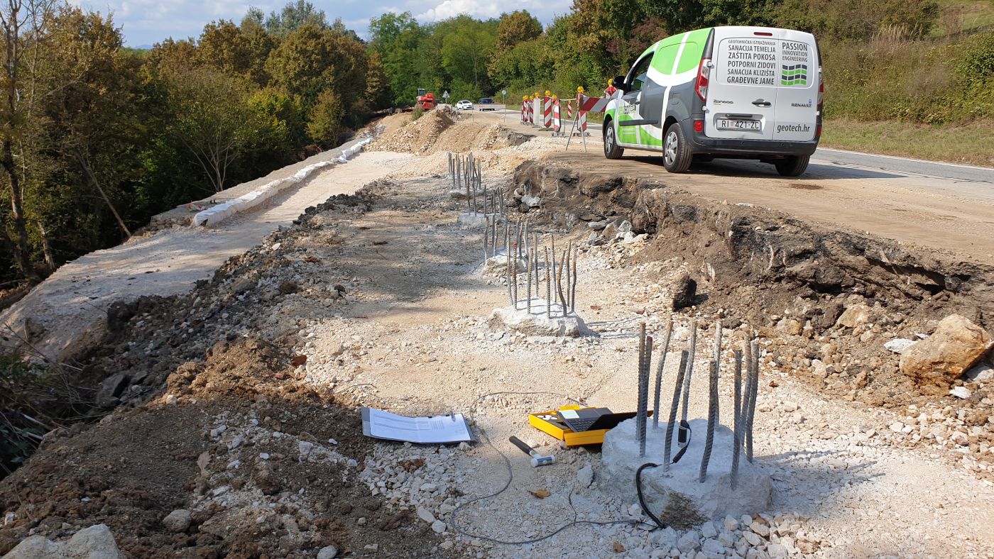
In order to monitor displacement during the road construction, three inclinometers of L=12.0 m were installed. A total of ten inclinometer measurements are planned (one measurement every three months).
Conclusion
The execution of works at the site lasted approximately 4 months. The works were carried out within the contractual period and in accordance with contractual obligations. The works were conducted in accordance with the contractual cost statement and the Investor’s requirements.
Read more: Brebornica landslide remediation on the DC1 state road